Thursday 19 April 2012

Quake Assesment - Japan Govt.

Source: Japan Times

Quake assessment projects nearly 10,000 dead in Tokyo

Latest projection takes into account lessons from the March 11 disaster


Staff writer

A massive quake beneath northern Tokyo Bay would kill about 9,700 people, the Tokyo Metropolitan Government said Wednesday.

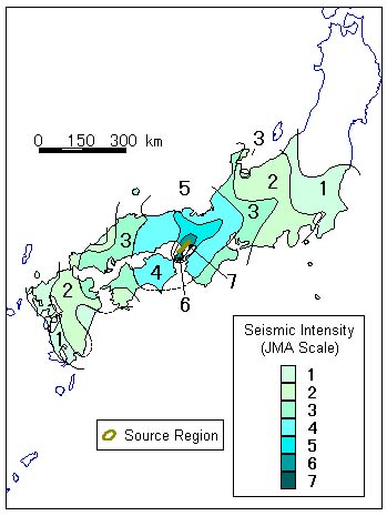
In its latest damage projection report, the metropolitan government said approximately 70 percent of the area covered by Tokyo's 23 wards would suffer a destructive temblor of upper 6 or stronger on the Japanese seismic intensity scale.

This is worse than the previous estimate of six years ago, which envisaged an earthquake of magnitude 7.3 striking the greater Tokyo area, and reflects new findings from the March 11 quake and tsunami. It also takes into account a recent study by the science ministry that a massive inland quake threatening the metropolitan areas will top the 7-level Japanese seismic intensity scale.

"Based on our estimate of possible damage, we would like to work on preventive measures," said a Tokyo official, adding that the metropolitan government plans to draft a revised disaster prevention plan for Tokyo by September.

In the latest estimates, the metropolitan government's disaster-prevention council listed four possible types of earthquake that could strike Tokyo: a magnitude 7.3 quake originating below either the northern Tokyo Bay or the Tama region in western Tokyo; a magnitude 8.2 plate-boundary quake in the northwest of Kanagawa Prefecture and a magnitude 7.4 quake on an active fault in the Tachikawa area of western Tokyo.

Six different projections based on varying wind speed and time of a day were also considered.

Of the four types, the northern Tokyo Bay quake scenario would result in the most casualties and building damage, while in the worst of the six projections, the quake would hit at 6 p.m. in winter with the wind blowing at 8 meters per second, the highest possible speed based on past data.

In the worst-case scenario, upper 6 quake would strike about 444 sq. km of eastern Tokyo, while some areas facing Tokyo Bay, including Ota and Koto wards, may experience a level 7 quake.

The 9,641 death toll is up from 6,413 in the previous estimate. About 5,600 would likely be killed by collapsing buildings and some 4,100 by fire, it said.

The number of casualties is expected to be high in areas packed with wooden houses in east and southeast Tokyo, the report said.

The metropolitan government also projected there would be some 3.39 million evacuees and some 147,600 people would be injured.

Meanwhile, the number of destroyed buildings declined to 304,300 from 471,000 in the previous estimate, owing to a decline in the number of old wooden structures and reinforcement work done on many buildings, it said.

For the first time the metropolitan government estimated the height of tsunami for a magnitude 8.2 "Genroku"-type earthquake that hit Tokyo in 1703, a so-called plate-boundary earthquake like the temblor that struck on March 11, 2011.

In the report, tsunami of up to 2.61 meters would flood an area of 4.6 sq. km to a depth of 50 cm, but no one would likely be killed.

The metropolitan government estimated intensity scales and damage for every 50 sq. meters within the 23 wards and municipalities and every 250 sq. meters for the remaining areas, which is more detailed than the previous report, the official said.

The latest study by the metropolitan government was conducted in light of the March 11 quake and tsunami that took the lives of more than 15,000 people.


Monday 2 April 2012

Research team releases new quake intensity maps for Tokyo


Tokyo could experience more intense shaking in the event of a magnitude-7 earthquake than has been previously forecast, according to a new intensity distribution map released by the science ministry on March 30.

According to a project team at the ministry that has been modeling the potential consequences of an earthquake centered directly under the capital, the intensity of shaking in Tokyo and Kanagawa Prefecture could reach the maximum 7 on the Japanese scale. While magnitude is a measurement of the energy released by the earthquake regardless of its depth, the "shindo" scale reflects the degree of shaking on the ground.

Previous maps made by the government's Central Disaster Management Council have never forecast that such quakes could register a 7 on the shindo scale, but the most recent map suggests that such intense shaking could hit Edogawa, Koto and Ota wards in Tokyo, as well as Kawasaki and Yokohama in Kanagawa Prefecture. Moreover, almost all of Tokyo's 23 wards could experience shaking of at least an upper 6 on the shindo scale.

The disaster council had previously projected that an earthquake on the Tachikawa fault could cause shaking that would reach an intensity of 7, but it had not said the same for a quake with an epicenter in the bay.

The ministry's team studied the subterranean structure of the Tokyo metropolitan area and found that a plate boundary capable of generating earthquakes was around 10 kilometers closer to the surface in some places than previously assumed by the disaster council. A shallower epicenter usually increases the intensity of shaking on the ground.

However, because of the complexity of Tokyo's subterranean structure, it is difficult to predict exactly where a quake will strike.

According to Kazuki Koketsu, a professor at the Earthquake Research Institute of the University of Tokyo and a member of the project team, "The entire southern Kanto region should prepare for the possibility of strong shaking from a quake directly under Tokyo."

The disaster council has produced maps for quakes with 18 different epicenters. Although there is no definite evidence that a quake has struck directly under Tokyo bay before, it was included in the modeling experiments because of the potentially catastrophic consequences on the capital.

Provisional calculations based on previous assumptions showed that around 25 million people would feel shaking of an intensity of at least lower 6 on the shindo scale.

The disaster council has predicted that in a worst-case scenario, a quake centered in the northern part of Tokyo Bay would kill 11,000 people and cause 112 trillion yen ($1.4 trillion) of damage.

In a different simulation conducted by researchers at Chiba University and other institutions, the arrival of rescue workers from areas west of Tokyo would be greatly delayed because of liquefaction under roads. Adachi, Itabashi, Kita, Shinagawa and Ota wards in Tokyo would be worst hit by such delays.

The latest study also calculated much greater damage to homes and infrastructure from a quake hitting the northern part of Tokyo Bay.

A total of 390,000 wooden homes would be totally destroyed, with 34,000 water pipes damaged. The worst-hit areas are likely to be Naka and Tsurumi wards in Yokohama, Sumida and Koto wards in Tokyo, and Chiba city's Chuo Ward in Chiba Prefecture, where the cities of Urayasu, Ichikawa, Funabashi and Ichihara will also be badly affected.

While the disaster council previously estimated that running water would be almost completely restored within four days of a major quake, the project team estimated that it would take two weeks to restore 70 to 80 percent of the water supply and sewage services.

The government has estimated that the southern Kanto region, which Tokyo is in, has a 70-percent chance of being hit by a magnitude-7 quake within 30 years.

The science ministry has compiled four different intensity distribution maps based on three different epicenters in northern Tokyo Bay, as well as for another quake centered between Chiba and Ibaraki prefectures, where quakes have struck in the past.

The intensity distribution maps have been posted to the science ministry's website at: (http://www.mext.go.jp/b_menu/houdou/).

http://www.japantimes.co.jp/text/nn20120403a9.html

http://www.japantimes.co.jp/text/nn20120401a1.html

Tuesday 13 March 2012

Quakes around 1855 and 1894

One thing that I've noticed is that there has been other quakes that precede and follow both the 1855 Ansei Edo quake and the 1894 Meiji Tokyo quake.

Is this significant? Well, I have no idea, to be honest, but I thought that it was worthy of noting, especially as northeast Japan had a massive one on 11th March.
One of the quakes, 15th June 1896 Meiji-Sanriku earthquake, was in a similar region, along the Japan Trench, to that of the March 2011 quake.
It must also be mentioned that the Japan Trench has regularly produced some huge quakes which can occur in locations extending from offshore Aomori Prefecture to offshore Ibaraki Prefecture,
Three of the top six quakes ever recorded worldwide, including the 2011 Tōhoku quake, appear to be clustered in a 6.2-year span between 2004 and 2011; however, experts construe this as a statistical anomaly or random chance.

Anyway, here's the quakes:

December 23, 1854 Ansei-Tōkai earthquake 8.4M
December 24, 1854 Ansei-Nankai earthquake 8.4M
November 11, 1855 Ansei Edo earthquake
April 9 1858, Hietsu Earthquake 7.0-7.1M

April 7, 1889 Kumamoto earthquake 6.3M
October 28, 1891 Mino-Owari Earthquake 8.0M
June 20, 1894 Meiji Tokyo Earthquake
June 15, 1896 1896 Meiji-Sanriku earthquake 8.5M


Study on Seismic Intensity 1855 Ansei Edo quake

"Study on the distribution of seismic intensity of the 1855 Ansei Edo earthquake in the Kanto District"

By Takahisa Enomoto.

PDF:
http://library.jsce.or.jp/Image_DB/eq1994/proc/00037/380-0201.pdf

Monday 12 March 2012

Depth of 1855 Ansei Edo quake

Location and Magnitude of the 1855 Ansei Edo Earthquake

American Geophysical Union, Fall Meeting 2005, abstract #S21A-0197
Japan Meteorological Agency intensity assignments from a set of recent calibration earthquakes were used to derive two intensity attenuation models suitable for estimating the location and magnitude M for historical earthquakes in Japan (Bakun, JGR, 2005). The "Honshu model" is appropriate for shallow crustal earthquakes. The "subducting-plate model" is appropriate for Pacific plate and Philippine Sea plate interplate and intraslab earthquakes. Intensities decrease more rapidly with distance from the source in the Honshu model than in the subducting-plate model, consistent with many studies showing that the colder, high-velocity, high-Q subducting Pacific and Philippine plates act as efficient waveguides for propagating strong shaking from earthquakes. M estimated from a set of intensity assignments is significantly larger for a Honshu-model source than for a subducting-plate model source. It is clear from the pattern of damage that the destructive 11 November 1855 Ansei Edo earthquake occurred near Tokyo, but the focal depth and causative seismogenic structure are controversial. M estimated using intensity assignments range from 7.2 and 7.4 for a subducting-plate-model source at 30 km and 70 km depth, respectively, to 7.7 for a shallow (5 km depth) Honshu-model source. The focal depth and causative seismogenic structure cannot be resolved from the pattern of intensity assignments. Historical accounts suggest that the 1855 Ansei Edo earthquake was preceded by alterations in groundwater and springs. In addition, 78 aftershocks were felt in Tokyo in the month immediately following the earthquake. These observations argue against a deep subducting-plate source. Surface faulting was not reported in 1855 and an order of magnitude more aftershocks were felt after the shallow crustal 1994 M7.3 Kobe earthquake -observations that suggest a somewhat deeper source for the 1855 Ansei Edo event. More felt aftershocks were reported in 1855 than after the 1987 off-Chiba M6.7 Philippine Sea plate intraslab earthquake (47 km focal depth). The 1855 aftershock activity and other historical accounts are apparently consistent with an M7.2 subducting-plate model source at about 30 km depth.
http://adsabs.harvard.edu/abs/2005AGUFM.S21A0197B

-------------------------------------------------------------------------------------------------

Insights on the 1855 Ansei-Edo earthquake depth derived from attenuation tomography and comparison with the 23 July 2005 M=6 shock

American Geophysical Union, Fall Meeting 2005, abstract #S21A-0198
The 3-D attenuation structure, Q, beneath the Kanto plain (Nakamura et al, 2003), Japan, has been obtained using short-period strong ground motion records from Kanto and Tohoku. Low Q is consistent with the Vp/Vs structure, and is associated with the active volcanic front (Nakajima et al, 2001). In addition, there is an unexpected low-Q zone oriented E-W beneath the Kanto plain. This low-Q band is coincident with high Poisson ratios, which have been interpreted as a serpentinized zone (Kamiya and Kobayashi, 2000). The heterogeneous attenuation structure must affect seismic ground motions for large events such as the damaging 1855 Ansei-Edo earthquake. First, we compare the distribution of seismic intensity between recent earthquakes and the Ansei-Edo shock. Despite the large and high quality intensity dataset for the 1855 shock, there are many difficulties in estimating its hypocenter. It is possible, for example, that different hypocenters produce the same seismic intensity distribution because of the complex attenuation structure. Considering these difficulties, we examine the ground motion of the Ansei-Edo and M=6 23 July 2005 earthquakes, and find out that the two intensity distributions are very similar. Second, we calculate the predicted ground motions using our 3-D Q structure for several trial 1855 hypocenters, principally in an attempt to infer whether the 1855 source was deep or shallow. Because of the observed high intensities characteristic of Kisarazu and the eastern Kanagawa prefecture shared by the Ansei-Edo and 23 July 2005 shocks, and the good match of these observations to the prediction using the 3-D Q structure, we infer a similar characteristic intensity distribution. We thus conclude that the 1855 Ansei-Edo earthquake may have occurred at the north end of Tokyo bay at a depth of about 70-80 km.

http://adsabs.harvard.edu/abs/2005AGUFM.S21A0198N

Kobe Quake video

Here's a couple of videos taken from Kobe as the quake kicks in.
A lot of talk about running out of the building as a quake happens, but judging from how much the buildings are moving, I'd say it would be very hard to navigate your way out of the door, especially if the door is blocked by one of the cupboards.
To add, it may be at night and the lights are out.
The Kobe quake was a duration of 20 seconds.
By the time the quake started and you've managed to pick yourself up off the floor, move several items that are blocking doors, forced the door open if the frame has been bent out of shape, and then got down several flights of stairs, safely, the quake would have been over.
And all of this whilst trying to remain upright.

You can see how strong the quake was from the initial jolt and seemed to calm down towards the end of the videos.
Must have seemed like a lifetime though.

In the second video you can see the motion that the quake sends the building in...almost circular.
Again, the running out of the building theory doesn't seem an option.


1995 Kobe Quake

January 17, 1995, M 7.2

The Southern Hyogo Prefecture Earthquake occurred on the Rokko-Awajishima fault zone that stretches from the Hanshin area of southern Hyogo Prefecture to Awajishima Island. During this earthquake, seismic intensity 6 in JMA scale was observed at the Kobe Marine Observatory and the Sumoto Weather Station. Field investigation have shown, however, that an area from part of the Awajishima Island to Kobe and Takarazuka corresponded to a seismic intensity of 7 in JMA scale. Seismic intensity 5 in JMA scale was observed in Kyoto, Hikone, and Toyooka, while ground motion corresponding to a seismic intensity of 5 in JMA scale was observed in Osaka, depending on the ground conditions (Fig.7-13, Fig.7-14). In addition to many wooden houses and concrete buildings, rail and highway lines collapsed, including those for expressways and the Shinkansen. The damage was extremely severe, totaling 6,427 dead and missing, more than 40,000 injured, more than 110,000 houses completely collapsed, and 285 fires (as of December 26, 1996) (Fig.7-15). The earthquake occurred in the early morning; thus, many of the deaths were the result of collapsing houses or fires. Harbor facilities were also damaged as a result of liquefaction, and the rains after the earthquake caused landslides as well as other damage. The damage caused by this earthquake is referred to as the Great Hanshin-Awaji Earthquake Disaster.

Slipping of the earth's surface at the Nojima fault (Nozima fault) on Awajishima Island resulted from this earthquake (Fig.7-16). The southeastern side of Nojima fault rose a maximum of 1.4 m to the northwest, and slipped a maximum of 2.1 m to the southwest. Observation of crustal deformations during this earthquake show that the area surrounding the focal region was compressed in an east-west direction and that the southeastern side of the Nojima fault rose to the northwest (Fig.7-17). It was also determined that the northwest side of the focal region rose to the southeast in the Hanshin area, in contrast to the uplift on Awajishima Island. These deformation suggest that the area was subjected to compression in an east-west direction. This is in rough conformity with the topography of the area and previously known crustal movements. No large-scale movement occurred in the Hanshin area, however. It is difficult to believe that the Rokko Mountain (Rokko Santi) area was formed by repeated earthquakes of the same type as the Southern Hyogo Prefecture Earthquake, so we must conclude a different type of earthquake was responsible for the formation of this area. For example, it has been suggested Linkthat the 1596 Keicho Fushimi Earthquake (M 7 1/2) might be this type of event.

Many felt and unfelt aftershocks occurred after the Southern Hyogo Prefecture Earthquake. This aftershock activity gradually diminished, with the largest aftershock (M 5.4) occurring about two hours after the main shock (Fig.7-18, Fig.7-19).

A Special Measures Law on Earthquake Disaster Prevention was promulgated after the occurrence of this earthquake, and the Headquarters for Earthquake Research Promotion was established.


1894 Meiji Tokyo quake

The Meiji Tokyo Earthquake June 20, 1894, M 7.0


This earthquake occurred in a location deep under the eastern part of Tokyo, and is thought to have been within the subducted Pacific Plate. Strong ground motion was felt, particularly on the coast of Tokyo Bay. Ground motion corresponding to a seismic intensity of 5 in JMA scale was felt in eastern Tokyo, eastern Kanagawa Prefecture, southeastern Saitama Prefecture, and other locations. In some areas, there was ground motion corresponding to a seismic intensity of 6 in JMA scale (Fig.5-32). There was heavy damage along Tokyo Bay coast in Tokyo and Yokohama, as well as 31 fatalities in total (Fig.5-33). Cracks and liquefaction of the ground occurred throughout the affected areas.

The precision of observation equipment was still not advanced at this time. Therefore, of the earthquakes observed in this area within one year after the main shock, only the one (M 6.7) occurring three and a half months after the main shock is thought to be an aftershock.


Sunday 11 March 2012

1855 Ansei Edo Quake quick notes.

Ansei Edo Quake 11th November 1855.

Magnitude: 7.0

Epicentre: Tokyo Bay. Now a built-up area. Closest station is Toyosu.
http://mapper.acme.com/?ll=35.65,139.8&z=11&t=M&marker0=35.65,139.8,1855%20Ansei%20Edo%20earthquake

Casualties: 7,000

Damage: Approx 50,000 houses detroyed by quake and subsequent fires.

Sites of interest

Japan Meteorological Association:
http://www.jma.go.jp/jma/en/menu.html


Home anti-seismic test:
http://www.kenchiku-bosai.or.jp/english/file/wagaya-e.pdf


Tokyo Govt. disaster prevention Info:

http://www.bousai.metro.tokyo.jp/english/e-athome/taishin.html


Future quakes. Quake research institute, Uni of Tokyo:
http://www.eri.u-tokyo.ac.jp/BERI/pdf/IHO81321.pdf


Quake Prediction Sites:
http://quakeprediction.com (updated daily)
http://geoq.ru/eindex.htm
I have followed these two sites for the past year, since 11 March, and have found that some of the predictions have been notable.


Headquarters for Earthquake Search Promotion:
http://www.jishin.go.jp/main/index-e.html


Global Disaster Watch:
http://globaldisasterwatch.blogspot.com/
Interesting blogspot that ran an interesting article here:
http://globaldisasterwatch.blogspot.com/2012/02/monday-february-20-2012.html


NASA Astropysics Database Systems:
http://adsabs.harvard.edu/cgi-bin/nph-basic_connect


Study and distribution of seismic intesity 1855 Ansei Edo quake:
http://library.jsce.or.jp/Image_DB/eq1994/proc/00037/380-0201.pdf

1855 Ansei Edo Quake

Regarding the 1855 Ansei Edo Earthquake (M 6.9), there are two ideas: first, it has been caused by active fault movement close to the surface; second, it has occurred on the upper surface of the Philippine Sea Plate.

The Ansei Edo Earthquake is thought to have occurred in a shallow or moderately deep area near the mouth of the Arakawa River (Ara Kawa). It generated strong ground motion over a wide area in the Kanto region, and its ground motion is estimated to have been the equivalent of seismic intensity 6 in JMA scale in eastern Tokyo, northwestern Chiba Prefecture, and eastern Saitama Prefecture (Fig.5-20 and Fig.5-21). This earthquake caused extensive fire damage over a wide area. Liquefaction of the ground is also known to have occurred in several locations. There were more than 7,000 fatalities in all. While there was no report of the tsunami generated by this earthquake, a large number of aftershocks are thought to haUve occurred (Fig.5-22). Historical data reveal that several phenomena occurred before the earthquake, including the spring of groundwater and ground rumbling.


About this blog

I was in Tokyo on the 11th March when the quake and tsunami struck the east coast of Japan.
I was on the train at the time when the immense shaking started...and went on...and on...and on.

Whilst the epicentre was a long way from Tokyo itself, it still wasn't the Big One that has been expected to hit the capital for years.

Confusingly, several quakes have been predicted and many reports have been written.

Quakes such the the 1923 Kanto quake, the Tokai quake, the 1855 Ansei Edo quake, and the 1894 Meiji quake.
The Tokai quake has been the one that the Japanese Govt. has been concentrating on and has been the focus of predictions.
This quake, whilst not having an epicentre in Tokyo, would cause damage to the city.

When a quake has been spoken of in and around the Capital, the Kanto quake has been the one that has been quoted by journalists in their reports.

Fresh research has scientists predicting the epicentre will be of that similar to the 1855 & 1894 quakes that struck in Tokyo Bay.
Scientists report that there is now a 70% chance of a Tokyo quake happening in Tokyo Bay area within 4 years.
So, after searching for information, it has led me to start this blog.
I aim to gather information from both of the Tokyo Bay quakes. Information about the Tokyo Bay quakes is hard to find as they happened at a time when technology wasn't as advanced.
I will also focus on the 1995 Kobe quake as a recent turn of events.
This quake has some interesting info that can in one way or another give us an idea what a quake in Tokyo might be like.

The Kobe quake was shallow and close to land. It was a 7.2 magnitude, which is roughly what is predicted in Tokyo.
Kobe is also a large industrial city.
However, the population is about a tenth of that of Tokyo's.
Still, as modern Japanese quakes go, Kobe is a good source of the potential devastation that is likely in Tokyo.

One of the things that I noticed when going onto some forums that there is a lot of fear-mongering and people giving the same information, over and over again.
It doesn't give one the best hope.
I'm gathering my information from history and compiling it into one blog.
It probably won't be a blog to seek help and advice on what to do in a quake, and I won't be telling anyone to stock up on dry food and fresh water, you should already know this.

Once again, this blog is about the predicted Tokyo Bay quake.